

- Oil Shock Sends Asian Markets Lower as Middle East Conflict Threatens Global Shipping |
- Trump Links Iran War to US Midterms, Backs United Ireland |
- PM Tarique Rahman Seeks Public Cooperation to Tackle Nationwide Dengue Outbreak |
- Jatiyatabadi Mahila Dal Vows to Lead Fight Against Rape, Violence Against Women and Children |
- 'Honorable' Dropped: PM Starts Implementing Decision from His Own Office |
Satellite imagery captures scale of destruction after Nepal floods
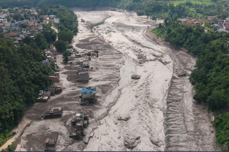
Image- Collected
Satellite images have provided scientists with new clues about the devastating floods along the Nepal-China border, indicating that a massive section of bedrock collapsed beneath a glacier before ice, rocks and debris surged through nearby valleys.
The disaster on Wednesday killed hundreds of people in Nepal and Tibet, while many others remain missing, including foreign nationals and religious pilgrims.
Scientists Kristen Cook and Dan Shugar initially faced difficulties examining the affected area because clouds and dust blocked satellite views. Early images showed that part of a glacier had broken away from Langtang Lirung peak near the Tibetan border.
Clearer satellite images taken Thursday later revealed that the bedrock beneath the glacier had also collapsed, sending a huge mass of ice, rocks and boulders into the valley.
Dan Shugar, an associate professor at the University of Calgary, said the evidence pointed to a major mountainside failure involving both the glacier and the underlying bedrock.
As the debris moved through the steep valleys, melting ice added water to the flow, while mud and rocks created a powerful torrent that swept through nearby communities, according to Cook of Université Grenoble Alpes.
Satellite images also showed a sharp expansion of the Trishuli River around Kolpurtar, Betrawati and Syapru Besi. The river’s colour changed from greenish to dark brown and black, reflecting the large amount of mud and sediment carried by the floodwaters.
Several settlements along the river were buried under debris, while Syapru Besi, a popular tourist destination and gateway to the Langtang trek, suffered extensive damage.
Mountain geographer Alton Byers of the University of Colorado Boulder described the affected area as a wasteland that could take years to recover. He said climate change may have played a role by accelerating the melting of glaciers and permafrost, which can weaken mountain slopes.
However, Cook and Shugar said there is not yet enough evidence to directly link the specific collapse to climate change. They noted that landslides and slope failures are natural hazards in mountainous areas, although continued permafrost melting could increase the likelihood of similar disasters in the future.